Soda Lake

Photos and such regarding Soda Lake
Entrance to the LORAN station, which was closed in 2010.
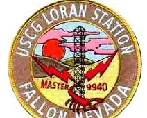
U.S. Coast Guard LORAN Patch (Patch photo courtesy Bluejacket.com)
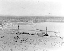
The soda works in 1880- now under water. (Photo courtesy Churchill County Museum)
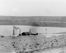
The soda works in 1869 (Photo courtesy Churchill County Museum)
The I.F. (Ick Factor) of Soda Lake is incredibly high when we visited
The surrounding countryside, looking in an easterly direction, generally.
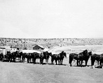
They hauled out soda with this 12 horsepower wagon. Photo courtesy Churchill County Museum.
The Placid, inviting waters of Soda Lake which is actually a volcano which would rain death and destruction any time it chose.
1868 Land Office Map
1908 USGS map with Soda Lakes highlighted
Clarence King Survey photo showing a much smaller Soda Lake
Date unknow, two hunters looing at the lake.
Depth chart of Big and Little Soda Lakes, from fishing-app.gpsnauticalcharts.com .